|
Click links to see current prices and availability, or to see if newer version is available. Laminated versions may also be available.
|
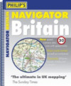
Philip's Navigator Britain 1.5 miles to the inch
Spiral-boundedition. Large scale detailed road atlas of Britain, 1.5 miles to the inch, includes details of canals, locks,
footpaths, etc. 50 indexed town plans.
1.5 miles to the inch
Spiral-boundedition. Large scale detailed road atlas of Britain, 1.5 miles to the inch, includes details of canals, locks,
footpaths, etc. 50 indexed town plans.
|
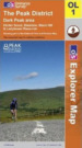
Peak District - Dark Peak Area
Ordnance Survey Outdoor Leisure Map (1:25 000)
The map shows the Peak Forest Canal between Woodley and Buxworth. It also shows the Huddersfield Narrow Canal between Standedge Tunnel and Stalybridge.
|
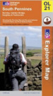
South Pennines
Ordnance Survey Outdoor Leisure Map (1:25 000)
The map shows the Rochdale Canal between Rochdale and Sowerby Bridge. It also shows the Huddersfield Narrow Canal between Standedge Tunnel and Slaithwaite and parts of the Leeds and Liverpool Canal between Keighley and Skipton,
and between East Marton and Hapton, including Foulridge and Burnley.
|
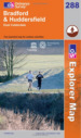
Bradford and Huddersfield
Ordnance Survey Explorer Map 288 (1:25 000)
The map shows the Huddersfield Narrow Canal from Slaithwaite to Huddersfield, the whole Huddersfield Broad, the Calder and Hebble from Salterhebble
to Horbury Bridge and the Leeds and Liverpool from Bingley to Armley, Leeds.
|
Leeds
Ordnance Survey Explorer Map 289 (1:25 000)
The map shows the Aire and Calder Navigation between Leeds, Castleford and Wakefield and the Leeds and Liverpool from Armley to Leeds.
|
Manchester and Salford
Ordnance Survey Explorer Map 277 (1:25 000)
The map shows the Ashton Canal, the Lower Peak Forest Canal, the Rochdale Canal between Manchester and Littleborough and the Manchester,
Bolton and Bury Canal.
|
Bolton Wigan and Warrington
Ordnance Survey Explorer Map 276 (1:25 000)
The map shows part of the Leeds and Liverpool Canal, part of the Bridgewater Canal, part of the Manchester Ship Canal and part of the former
Sankey Canal.
|
West Pennine Moors, Blackburn, Darwen and Accrington
Ordnance Survey Explorer Map 287 (1:25 000)
The map shows part of the Leeds and Liverpool Canal between Hapton and Adlington, including Blackburn.
|
Sheffield and Barnsley
Ordnance Survey Explorer Map 278 (1:25 000)
The map shows The Sheffield and Tinsley Canal, part of the South Yorkshire Navigation and part of the line of the former
Barnsley Dearne and Dove Canal.
|
Liverpool, St Helens, Widnes and Runcorn
Ordnance Survey Explorer Map 275 (1:25 000)
The map shows part of the Leeds and Liverpool Canal between Melling and Liverpool, the Bridgewater Canal between Walton, Preston Brook and
Runcorn, part of the Manchester Ship Canal and most of the former Sankey Canal.
|
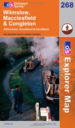
Wilmslow, Macclesfield and Congleton
Ordnance Survey Explorer Map 268 (1:25 000)
The map shows the Macclesfield Canal and part of the Trent and Mersey Canal between Kidsgrove and Sandbach.
Laminated edition: £12.59
|
Doncaster, Conisbrough, Maltby and Thorne
Ordnance Survey Explorer Map 279 (1:25 000)
The map shows the South Yorkshire Navigation between Conisbrough and Bramwith, the Stainforth and Keadby Canal between Bramwith and Thorne,
the New Junction Canal, part of the Aire and Calder Navigation and parts of the Chesterfield Canal.
|
|
|
|
A-Z of Greater Manchester
Street Atlas
|
A-Z of Lancashire
Street Atlas
|
A-Z of South Yorkshire
Street Atlas
|
|
|
A-Z of Sheffield
Street Atlas, including Chesterfield, Barnsley, Rotherham, Doncaster
|
A-Z of West Yorkshire
Street Atlas
|