The photos on this page were taken in November and December 2007 by John Fletcher. Photos of this section of canal taken in 2005, before work started, can be found here.
Photos of the completed section of canal taken in 2008 can be found here and photos of the first boats on the newly restored canal section are here.
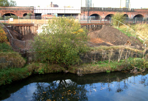
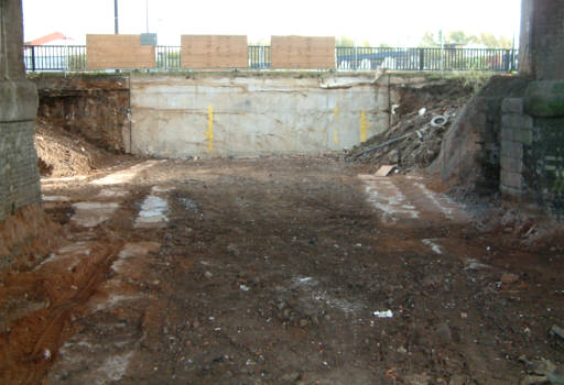
The former junction with the River Irwell at Salford. The indentation to the left shows where boats went under "Bloody Bridge" and into the staircase Locks 1 and 2. The canal then passed under the railway bridge in the background. Behind the tree, the ground is being cleared ready for a new channel to be constructed at river level to pass under the Salford Inner Relief Road. The new entrance from the river will be wider than the original one that went into the locks.
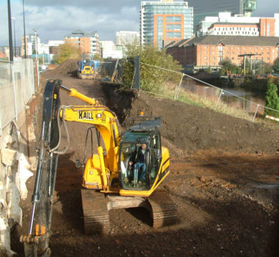
Nov 07: Clearing the ground between the river and the Salford Inner Relief Road. When the road was constructed, two rows of concrete piles were sunk to enable a tunnel to be excavated at this point. The late Margaret Fletcher, then Chairman of Manchester Bolton and Bury Canal Society, facilitated £350,000 to pay for the design and construction of a tunnel under this road as it was being constructed and, when opened, the tunnel will be dedicated to her memory.
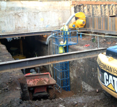
Dec 07: The same location as the previous picture. The chamber of the original Locks 1 has been excavated, including part that is now under the Inner Refief Road. It had been planned to construct a new, wider channel at this point, but the lock chamber walls are in such good condition that a re-design will mean keeping the lock walls in place as the channel walls.
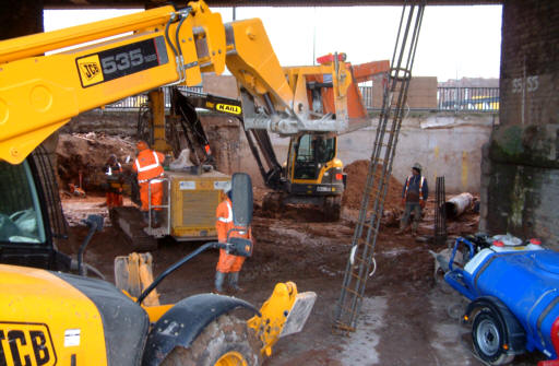
Dec 07: Another view of the excavation. The site of Lock 2 of the lock staircase is completely beneath the new road. Contractors are now digging into bedrock below the original Lock 2 chamber to extend the channel right through to the new lock beyond the railway. The fan is extracting diesel fumes from the confined working space.
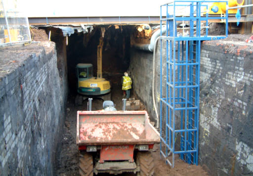
Nov 07: Looking back from below the railway bridge to the point where the Margaret Fletcher Tunnel will pass under the Salford Inner Relief Road. Because of the demolition of the original two locks from the river, the canal will reach this point around 5 metres lower than originally. The yellow markings indicate the alignment of the tunnel entrance, which will be lower down.
Dec 07: The same location as the previous picture. Piling has now started for the side walls of the channel on the north side of the Inner Relief Road. This is made more difficult bythe restricted headroom beneath the bridge.
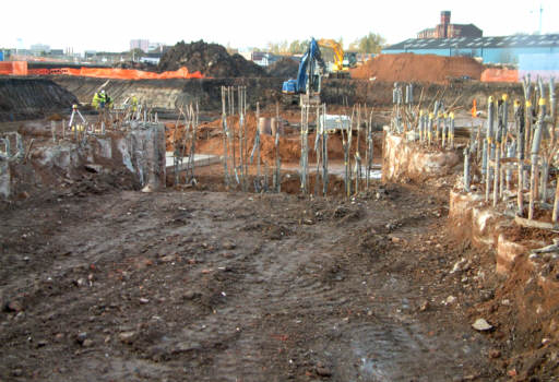
Nov 07: To the west of the railway, concrete piles mark the site for the new deep lock. It had been planned to have a single lock here and a second to the west, but the discovery of a Victorian sewer meant that the canal had to be raised to its original level from this point, which will be achieved by a single deep lock with a rise of around 5 metres. Piling has also been done for a back-pumping chamber here, to retain water levels above the lock.
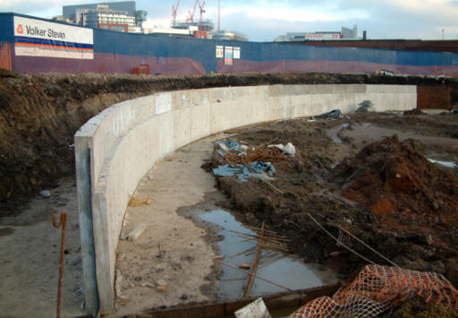
Dec 07: The newly constructed wash wall of the circular basin above the new deep lock, which will be located off to the right of the photo.
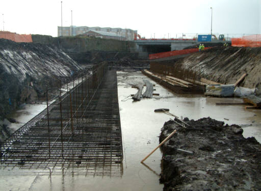
Nov 07: Looking west towards East Ordsall Lane Bridge. This was to have been the location for the new Lock 2, which will now be replaced by a deeper Lock 1. Steel reinforcements are in place for the construction of new concrete wash walls.
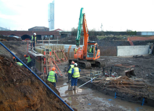
Dec 07: Wash wall construction for the basin below East Ordsall Lane Bridge.